The Mississippi River and Elvis
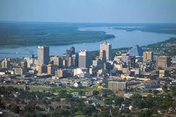
Memphis, Tennessee is a port on the Mississippi River and the home town of the King of Rock'n Roll performer Elvis Presley.
LeRoy W. Hooton, Jr.
April 28, 2011
Memphis is situated on the Mississippi River, with the 4th largest inland port in the U.S.

In mid-April my wife and I traveled to Memphis where we had the opportunity to take in two of the main sights: the Mississippi River and the King of Rock'n Roll Elvis Presley. I like Elvis and showed it by plunking down $28.39 (senior price) for each of us to tour Graceland. The mighty Mississippi has always been of interest to me and Memphis provided me an educational opportunity to visit Mud Island and the local levees that delineates the river's flood plain.
Memphis was founded in 1819 and was named after the ancient capital of Egypt on the Nile River. Today the city consists of approximately 750,000 residents. Its International port on the Mississippi River is the 4th largest inland port in the United States.
The Mississippi River is the largest river system in the U.S., with 2,320 miles of river from its head waters in Minnesota, then collecting water from various river tributaries, ending at the Gulf of Mexico 90 miles south of New Orleans. The Missouri River is the largest tributary to the Mississippi River, and at the point that they join together north of St. Louis, it is the larger of the two. The river's watershed is comprised of an area that lies between the Rocky Mountains on the west to the Appalachian Mountains on the east. Author and humorist Mark Twain made the river famous through his novels of the adventures of Tom Sawyer and Huckleberry Finn in the nineteenth century.
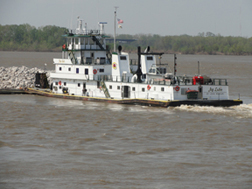
The commercial use of the Mississippi River has been a major contribution to the economy of U.S. The river is a transportation system for moving 300 million tons of cargo from the nation's heartland to both national and international markets. The advantage of this inland waterway is the efficiency of moving huge volumes of bulk commodities by the use of towboats pushing barges lashed together over long distances.
|
The Mississippi River is the dominant geographic feature framing Memphis, which is located on a bluff above the flood plain of the river. The 5.9 mile-long Hernando DeSoto Bridge provides access to downtown Memphis from the west on I-40. Near the east side of the bridge on the Mississippi River is Mud Island and Museum Park, which gives its visitors an opportunity to experienced the River Walk, which is a 2,201:1 scale topographically accurate model of the river depicting its course from the headwaters near the Canadian border to the Gulf of Mexico. The model allows one to walk on the replicated river over the approximately one-half mile distance, crossing bridges and cities along the river's course. The workmanship of the model is excellent and gives the viewer an idea of the enormous size of the Mississippi River and its tributaries.
The flows of the river fluctuate from season to season and from year to year. The average flow into the Gulf of Mexico is between 200 and 7,000 million cubic feet per second. The annual flow is two times higher than the Columbia River and 40 times than that of the Colorado River.
High flows in the Mississippi River have caused destructive floods. Because of these floods artificial levees have been constructed to contain the high flow waters. The 3,500 miles of levees on the Mississippi are one of the largest systems in the world.
The Great Flood of 1927 inundated 27,000 square miles of land causing $400 million of damages and killing 246. The river below Memphis reached a width of 60-miles, ten times its normal size. Again in 1993, flooding occurred on the Mississippi and its tributary the Missouri River inundating 30,000 square miles of land and inflicting $156 billion in damages. Projections this year indicate flooding on the Mississippi. In an April 19, 2011 news report flooding again was predicted due to above normal precipitation and high snowpack in the northern watersheds.
In early June 2004, I was able to observe the Mississippi River in the St. Louis area. The high waters had reached the levees submerging the flood plain and farmlands, including structures. Many of the rural streets were blocked off. In Memphis, I was able to inspect up-close the earthen levees that contain the waters within the flood plain along this segment of the Mississippi.
|
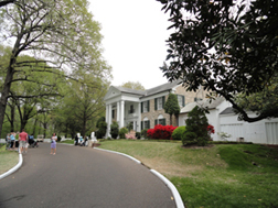
Memphis is known for its music. Beale Street is the center of the city, with several blocks of shops, bars and entertainment establishments. The street is blocked off at night and heavily policed. The different sounds of music reverberate into the street full of pedestrians and customers enjoying the night life. There is a variety of music from jazz, blues and rock'n roll. Several miles away is the home of Elvis Presley, which has grown into Graceland, a mecca for tourists and Elvis fans. The enterprise consists of a number of attractions supporting the Graceland Mansion. In 1991, Graceland was listed on the National Register of Historic Places; visitations to the mansion was second only to the White House.
Living in the second driest state in the Union, it amazes me that in the time that it takes to make a 2 hour airplane flight, I could walk on the banks of the largest river in the nation in a climate and hydrological setting completely different from my own. In the West, rivers and canals are primarily used to convey water supplies to municipalities and agricultural users. In the Mid-west and East rivers and canals are primarily used for transportation and commerce.

