GIS Revolutionizes Utility's Efficiencies
Salt Lake City Department of Public Utilities envisions GIS technology as the tool to achieve organizational success.
March 20, 2008
|
Public Utilities director Jeff Niermeyer believes GIS is a powerful tool that will successfully propel DPU into the future. “GIS will integrate the department’s business, operations and maintenance, and engineering divisions into a cohesive efficient organization,” says Niermeyer. He envisions an employee friendly, desktop system, providing information across divisional boundaries, available to everyone who needs it to perform their jobs.
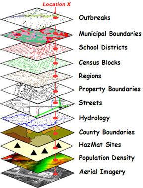
GIS technology is a computerized system that utilizes data layers tied to a geographic location. These layers can include, but not be limited to, municipal and school boundaries, census blocks, property boundaries, streets, utility locations, hydrology, county boundaries, HazMat sites, population density and aerial imagery, to name a few. These layers can be laid over the base map showing their relationship to the geographic location (See Figure No. 1).
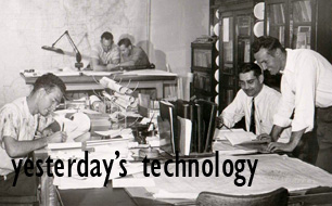
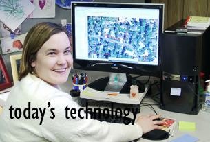
Before GIS, water, sewer and stormwater mapping was accomplished by manual drafting. This process was labor intensive and limited to other applications. On the other hand the number of application options with GIS technology is growing by leaps and bounds.
In 1990 the decision was made to create an enterprise fund to finance the Storm Water Utility with user fees. It was necessary to determine lot sizes because the user fee was based on the amount of impervious (hard) surfaces on each commercial and industrial property parcel, which would create run-off into the public stormwater system. Aerial photos and GIS technology were used to measure these "impervious” areas, which were digitized from 100-foot aerial photographs. This showed the buildings and impervious footprint for each parcel. Each commercial and industrial parcel has a unique fee based on this information. Residential fees were based on the size with a fixed dollar amount based on average or extra-large lots.
Record stormwater system drawings were not available, so new maps for these facilities had to be generated. The storm drain system was mapped using a global positioning system (“GPS”), which allows field data to be captured with attribute information in the correct coordinate system.
With the success of the stormwater project, the decision was made to include the mapping of the water and sewer systems on GIS.
The water distribution system requires 797 maps on 24x36-inch sheets at 100 foot scale; the sewer and storm water systems consists of 580 maps each at the same scale. Map sizes and scale are produced in any form desired, depending on the use.
The productivity of GIS is immeasurable says GIS manger Nick Kryger. Today all three utility’s water, sewer and stormwater system maps are completed. These maps are used by DPU to operate and maintain the systems, design capital improvements and for Blue Stake locations. “I can't give an exact number, but I'd say that over the past several years, GIS work output
|
DPU responds to about 3,000 location calls per month by Blue Stakes. Accurate maps are critical for these facility locations, which are out of-sight buried below the ground in utility corridors.
Besides mapping, GIS provides the platform for modeling utility performance such as hydraulic flows, water quality, and security functions. In recent years, GIS modeling capability has been invaluable in designing water distribution system improvements to improve fire flows.
Further, GIS is used by other city departments: such as planning, fire and police, for specific information they may need. For example, the location of fire hydrant and fire flow volumes is information important to the Fire Department.
GIS allows DPU to satisfy its customer's service needs by e-mailing maps and information electronically directly to authorized planners, contractors, developers, and engineering firms in a timely manner. Custom sized maps can be produced and emailed to customers using smart PDF files.
During the 2002 Winter Olympics held in Salt Lake City, DPU's GIS department was able to demonstrate its professionalism when it was a key component of Homeland Security and the Utah's effort to protect the public and athletes during this international event.
Another advantage of GIS is its interface with GPS, which eliminates the need to send a surveying crew to locate utility facilities and then transfer field notes onto the maps.
DUP’s efforts have not gone unnoticed. In 2004 the GIS department was recognized by receiving the ESRL's “2004 Special Achievement in GIS Award.”
In 1999, Kryger predicted a bright future for GIS when he said “It’s growing exponentially with each new application.” His prognostication has come to fruition and the future uses of GIS by DPU are just beginning. “Based on the GIS advancements made during the past decade, it appears that future uses of GIS are almost limitless,” avers Kryger.
.


