Winter Snowpack Low in Wasatch Mountains
Lower than normal snow and early melt draws concern
Larry Alserda Hydrology Specialist Salt Lake City Public Utilities
April 3, 2007
|
When I did the April 2007 snow surveys, I found that the two lower elevation sites were already dry and two other sites in Brighton and Alta were at, or near historical lows. The most startling observation was measuring the lowest snow ever at Mill-D in Big Cottonwood Canyon (based on 72 years of record). This year most of the sites have less than half of the snow water content compared to last year at this same time.
Not only is the snowpack below normal the snow (even at high elevation) is melting early by as much as 6 weeks. Most people in the Salt Lake Valley are just beginning to use outside water. In other words we are not utilizing much of the diminished snowpack, except where there are reservoirs to capture the runoff.
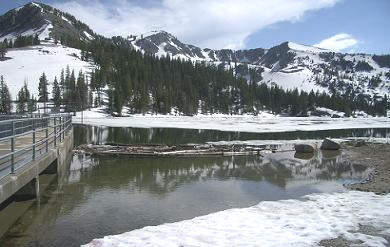
Our reservoirs are being managed to capture as much runoff as possible. Salt Lake City Public Utilities is diverting water from Lambs Canyon stream in Parleys Canyon into Little Dell reservoir. The larger reservoirs such as Deer Creek and Jordanelle are at least 80% full. Utah Lake is full and the gates opened to allow free flow from the lake to the Jordan River.
The groundwater moisture is better than normal since we are coming off of two wet years.
As always conserving water is a good idea especially since we do live in a semi arid region that is subject to low snow winters.
Last September a friend of mine who works for the U.S. Weather Service was doing an interview on a local television station. He told the reporter that everything in their models indicated another good winter with lots of snow. After the interview I told him that I felt this winter could be drier than the past few winters. My reasons were first that we seldom have 3 wet winters in a row and that we had just finished a week or so of cool and wet weather in September. My theory is early rain means late snow. I didnt known how right I was going to be.
| Depth |
Inches of |
Percent |
Date |
Percent |
|||||||
| Location |
Watershed |
Elevation |
in inches |
Water |
Density |
Sampled |
of Normal |
||||
| Alta Central |
Little Cottonwood |
8800' |
66 |
23.7 |
36 |
30-Mar |
65 |
||||
| Brighton Cabin |
Big Cottonwood |
8700' |
52 |
15.9 |
31 |
29-Mar |
59 |
||||
| Mill D |
Big Cottonwood |
7400' |
30 |
7.9 |
26 |
29-Mar |
41 |
||||
| Hidden Springs |
City Creek |
5500' |
0 |
0.0 |
0 |
27-Mar |
0 |
||||
| Killyon |
Emigration |
6200' |
0 |
0.0 |
0 |
30-Mar |
0 |
||||
| Millcreek |
Millcreek |
7000' |
46 |
12.5 |
27 |
29-Mar |
62 |
||||
| Lambs |
Parleys |
7600' |
28 |
8.1 |
29 |
29-Mar |
52 |
||||