Little Dell Dam Instrumentation
Modern instrumentation technology helps monitor the performance and safety of Little Dell Dam located in Salt Lake County, Utah.
Frank Hamilton, P.E.
July 16, 2003
|
Embankment Instruments
The embankment was equipped with instruments to measure water pore pressures and embankment movementcritical information needed to assess the stability and safety of the embankment. Little Dell has 16 inclinometer locations. These are used to monitor lateral movements in the embankment, which occur below the ground surface. Data is collected on an annual basis and plotted. Displacements are then compared to previous years plots. They also give a record of vertical displacement at each location.
Vertical data is collected at the same time and settlement is graphed on a cumulative curve to observe overall settlement with time. Piezometric water levels in the tubes are also collected and plotted on a monthly basis.
In addition to inclinometer measurements, lateral and vertical movement is also monitored from the 39 surface monuments and measured with conventional survey techniques. Current schedule is on a 5-year basis to coincide with the periodic inspections on the following year.
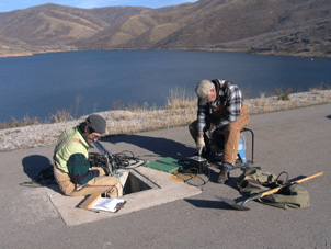
Little Dell is equipped with 70 functioning direct bury and 20 open tube vibrating wire piezometers which record hydrostatic pressures in the foundation and the embankment of the dam. Twenty-seven of these instruments are recorded manually and plotted on a weekly basis. The rest are compiled monthly. Piezometric water level data is compared to pool elevation to monitor the overall performance of the embankment, impervious core, transition zone and foundation of the dam. This data shows changes as compared to fluctuating water levels in the reservoir. All of the vibrating wires are connected to an automated data collection network that records piezometric water level data at 12-hour intervals and downloads the results onto a computer.
Other geotechnical instruments include five accelerographs to record seismic events. When triggered by an event, the controller automatically initiates recording of the vibrating wires on 10-minute intervals to determine if any changes or impacts to the embankment pore pressures have occurred. The recent 5.9 magnitude earthquake in Afton, Wyoming in February 1994 triggered accelerograph A-3 located on the crest in the center of the dam. A slight jump in pore pressure on one of the vibrating wire piezometers was noted.
Seepage flows from the drain blanket and associated springs are also monitored using a parshall flume and a v-notch weir. All measurements show fluctuations in flow based on fluctuating water levels in the reservoir.
Results
The current technology allows for continuous real-time monitoring of the dams performance. Problems associated with unusual settlement, slope stability, pore pressures or seepage may be detected and addressed in the early stages of development before they become too difficult to correct.