Sugar House Park Pond
November 1, 2002
|
(Salt Lake City, Utah) -- Sandwiched between 2100 South on the north; 1300 East on the West; I-15 on the south; and 2000 East on the East, Sugar House Park is 180 acres of green space situated in urban Salt Lake City. Managed and operated by the Sugar House Park Authority, the park provides solace and recreation opportunities for thousands of county residents. Activities include playgrounds, picnic areas, soccer fields and lots of green space. In addition to the use by picnickers, soccer players and joggers, this park has become a major community gathering point for fireworks in July and tubing in the winter.
The park site historically was a penal institution for the state of Utah. For nearly a century, the walled facility was a territory and then a state prison. First constructed in 1854, the facility was abandoned in 1951, when the prisoners were moved to the Point of the Mountain prison. One hundred and eighty acres were turned over to Salt Lake City and county for a park and 30 acres to the Salt Lake City Board of Education for a school. The buildings and wall surrounding the prison were demolished to make way for the new public facilities.
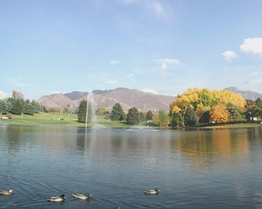
Parley’s Creek bisects the park, entering near the eastern extremity of the park via a 7-foot diameter culvert. Parley’s Creek winds its way through the center of the park until it enters the flood detention pond near the western edge of the park. During low flow stages of Parley’s Creek, the pond serves as a duck pond, controlled at its western edge (on the east side of the lower road) by a concrete overflow structure and wood slat headgate. During flood flow periods of the year, the pond serves as a flood detention basin, controlled by a flood control spillway and hydraulically operated headgate at 1300 East. These control structures were installed in 1981.
During these high flow periods of the year when flows are controlled by the flood control structure at 1300 East, the pond fills thus flooding the lower road and some of the remaining lower park area. This was the case during the 1983 flood when this detention basin became the primary line of defense against flooding 1300 South Street from State Street to the Jordan River. This large flood control detention basin can store up to 80 acre-feet of stormwater. Even during minor storms this detention basin becomes the first place where the City Crews try to control and manage the flood flows through the City’s drainage system.
The flood water from Parley’s Canyon flows into the detention basin, and then disappears under 1300 East to surface again on the west side of 1300 East. At approximately 10th East the creek flows into a stormdrain, not to surface again until the Jordan River. The detention basin is an important part of Salt Lake County’s flood control system. The detention basin stores water during high run-off periods and during storm events that if the runoff is not detained, causes downstream flooding. The detention basin is operated in unison with the detention basin located in the southeastern portion of Liberty Park. Stormwater is impounded in the two detention ponds during the peak flow period, and released slowly to keep the stormdrain pipe from overflowing.