Bulletin Board
The Colorado River
LeRoy W. Hooton, Jr.
August 27, 1999
Introduction
|
|
Major John Wesley Powell first explored the Colorado River in 1869. He and nine others in four boats traveled almost 1,000 miles down the Colorado River through uncharted canyons. The expedition began on May 24 on the Green River at the Green River Station, Wyoming and ended in the Grand Canyon on August 29 at the mouth of the Virgin River. After the adventure, Powell hit the lecture circuit raising funds for a second expedition in 1871 that produced a detailed map and scientific publications on the Colorado River. He would later have a career with the federal government, first as director of the U.S. Geological survey and then with the Smithsonian's Bureau of Ethnology until his death in 1902.
As pressure grew to settle the West and promote family farms, as early as 1878 Powell urged Congress to adopt federal reclamation as a means to enable western homesteaders to settle the land. Under Powell's direction, the Geological Survey conducted surveys, marked off potential dam and reservoir sites, and mapped proposed canals and ditches to irrigate the arid West. Powell is considered the father of federal reclamation as a means of strengthening the family farm and settling the West.
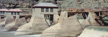
The Colorado River is the most significant water feature of the western United States, affecting cities, agriculture, and electrical power for the states and Indian tribes holding water rights in the river. Today the Colorado River serves nearly 25 million people and irrigates more than 1.8 million acres of land, producing 15 percent of the nation's crops and 13 percent of its livestock. The river produces more than $1.5 billion a year in agricultural benefits. Furthermore, the river provides 4,000 megawatts of hydroelectric generating capacity and 20 million annual visitor-days of outdoor recreation.
|
|
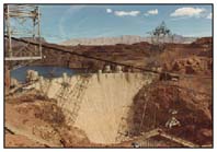
Within the State of Utah the Green River is a major tributary of the Colorado River, joining it southwest of Moab, Utah. Flaming Gorge Dam in northeastern Utah controls the flows of the Green River within Utah. Glen Canyon Dam, located south of the Utah-Arizona border, forms Lake Powell. These dams and resulting lakes are popular recreation areas within the state. Over 3 million visitors a year recreate on Lake Powell and its water-filled canyons.
Colorado River Compact
Water from the Colorado River was first diverted during the late 1800s through a canal constructed through Mexico to California's Imperial Valley. Mexico allowed the canal in exchange for a portion of the water. The Imperial Valley farmers wanted a canal that was within the United States, and in order to accomplish this, enlisted the aid of the federal government. The other six basin states did not want California to build the canal unless their future rights to the Colorado River were protected. This led to the 1922 Colorado River Compact and construction of the "All American Canal" to the Imperial Valley.
The waters were divided in perpetuity among the seven states and American Indian tribes in 1922 under the Colorado River Compact. Under the Compact, the Colorado River was divided into the Upper and Lower Basins. Each basin was allocated 7.5 million acre-feet of water annually. Furthermore, under a 1944 treaty, Mexico was guaranteed 1.5 million acre-feet annually, for a total of 16.5 million acre-feet annually as measured at Lee's Ferry. Evaporation from reservoirs reduces the total flow by an additional 2 million acre-feet annually. Since the annual flow has only averaged 14 million acre-feet since 1930, there is a shortfall in the amount of water available to meet the total demands on the river.
Water disputes and growing thirst
The waters of the Colorado have long been the source of conflict between the various states. The 1922 Compact contemplated settling the issue of allocation of the waters. Historically California and Arizona have been the chief antagonists fighting over the allocation of water to the Lower Basin states. In 1924 Los Angeles applied to divert 1.1 million acre-feet annually from the Colorado River. Los Angeles and other southern California cities formed the Metropolitan Water District (MWD) to build an aqueduct and serve as a water wholesaler for the area. In 1944, Arizona ratified the Colorado River Compact and began making plans to use its allocation of water. Disputes between Arizona and California led to Arizona filing a suit in the U.S. Supreme Court, entitled Arizona v. California in 1952. The court ruled in 1963 that California's water allocation of the mainstem of the Colorado River was 4.4 million acre-feet instead of 5.3 million acre-feet its users had contracted for. California was also awarded 50 percent of the surplus water. Arizona's allocation was set at 2.8 million acre-feet and 46 percent of the surplus and Nevada's 300,000 acre-feet and 4 percent of the surplus. In 1990, for the first time the Lower Basin states of California, Nevada and Arizona fully consumed their allocation of 7.5 million acre-feet of the mainstem of the Colorado River.
The U.S. Supreme Court established American Indian Rights earlier in 1909 in the Winters v. United States decision. The Court held that the Indians reserved water rights existed whether the tribes were using the water or not. This decision was reaffirmed in Arizona v. California when the Court awarded water rights to five Indian reservations in the Lower Basin.
As the Lower Basin grows, the waters of the Colorado continue to be critical. Expanding populations in southern California and southern Nevada have created additional demands on the Lower Basin allocation. There is growing pressure to conserve water and transfer agricultural irrigation water for municipal use. Currently about 85 percent of California's Colorado River allocation is used for irrigation purposes. In 1989, the MWD and the Imperial Irrigation District (IID) entered into an agreement whereby MWD pays $200 million for water conservation in IID in exchange for 106,000 acre-feet of water annually for 35 years. Thus far MWD has spent over $121 million dollars in conservation measures, saving approximately 73,000 acre-feet of water annually.
In an effort to pair back its use of Colorado River water, the MWD has also invested in water conservation. Mr. Jay Malonowski reported to the 1998 Colorado River Water Users Association at their annual meeting that municipal water usage had decreased 39 percent from 2.8 million acre-feet in 1990 to 1.7 million acre-feet in 1998, while the population served by the water wholesaler increased by 400,000 people per year.
Booming Las Vegas and Clark County, Nevada are the fastest growing areas in the nation. The population of Clark County increases by 200 residents every day. It is estimated that Las Vegas will fully use its 300,000 acre-foot allocation by the year 2015, and is now aggressively seeking additional water supplies. Pat Mulroy, Manager of the Southern Nevada Water Authority, is quoted in the "Western Water" as saying, "Nevada will not go away. There has to be a water solution for southern Nevada." Other than more water from the Colorado River, there does not appear to be another solution at hand. Ground water development within Nevada or tapping the Virgin River are problematic and may not be viable solutions to the area's water supply needs.
Utah's share of the Colorado River
|
|
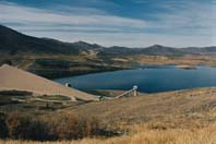
The Strawberry Valley Project
Capturing Utah's share of the Colorado River has been in the making for nearly a century. On June 17, President Theodore Roosevelt signed the Reclamation Act of 1902. Probably because of this federal irrigation legislation, two months later a group of farmers and civic leaders from Spanish Fork, Payson and Salem traveled to the Strawberry Valley to investigate the possibility of diverting water from the Colorado River Basin to the Great Basin (Wasatch Front) for irrigation purposes. As a result, in 1903 the Bureau of Reclamation was called upon for preliminary surveys for supplemental storage facilities. Subsequently, the Strawberry Valley Project was one of the earliest projects investigated under the new federal irrigation legislation. The project diverted the waters from Uinta Mountain streams as far east as the Yellowstone River for storage in a reservoir in the Strawberry Valley. A tunnel driven through the Wasatch Divide conveyed the water into the Spanish Fork River. Construction was authorized on December 15, 1905 and was the first large-scale transbasin diversion from the Colorado River to the Wasatch Front.
The Strawberry Valley Project provides irrigation water for 17,300 acres of farmland, with supplemental water for an additional 27,300 acres in southern Utah County.
The Provo River Project
The second project to tap a portion of the state's Colorado River allotment for use in the Great Basin (Wasatch Front) was the Provo River Project. Conceived in the early 1930s, Salt Lake City was the driving force in building this project. Diversions from the Weber and the Duchesne rivers, along with surplus flows on the Provo River made up the water supply for storage in the 150,000 acre-foot Deer Creek Reservoir located on the Provo River. In order for Salt Lake City to participate in the Bureau of Reclamation project, it was necessary to form the Metropolitan Water District of Salt Lake City. In 1935, this new entity joined with five other newly formed metropolitan water districts, one conservation district, seven mutual irrigation companies and two small farming companies to form the Provo River Water Users Association. This entity in turn contracted with the federal government to manage the project when completed and to meet the repayment obligation to the federal government. The Metropolitan Water District of Salt Lake City acquired 61.7 percent of the stock in the Provo River Water Users Association, providing 61,700 acre-feet of water.
Deer Creek Reservoir was completed in 1941. Other features of the project were completed later. Municipal water deliveries to Salt Lake City began in 1951. The trans-basin diversion from the North Fork of the Duchesne River, located in the Colorado River Basin was accomplished by constructing a six-mile tunnel through the divide. The tunnel has a capacity of 375 cubic feet per second. The total amount that can be diverted from this trans-basin works is 48,500 acre-feet.
The Central Utah Project
The Bureau of Reclamation studied additional water development of the Colorado River from 1939 to 1943 under a contract with the State of Utah. The study proposed developing 1,000,000 acre-feet of water from the Green River conveyed to the Wasatch Front. This study proved unsuccessful and was suspended in 1943.
Another study was initiated in 1945 with the focus to expand the existing Strawberry Valley Project. This study was the origin of the Central Utah Project. This project contemplated intercepting 11 streams along the Uinta Mountains to Little Brush Creek and conveying up to 600,000 acre-feet of water to an enlarged Strawberry Reservoir.
The 1945 study was refined over the years, reducing the amount of water conveyed from the Colorado River Basin to the Wasatch Front to about 132,000 acre-feet. The Strawberry Aqueduct (collection system) would be extended eastward about 37 miles to Rock Creek. Salt Lake City subordinated its filings on Rock Creek to facilitate the project. The Strawberry Reservoir would be enlarged to a total capacity of 1,370,000 acre-feet. Additional projects in the Unita Basin would complete the project.
|
|
The Central Utah Water Conservancy District was established on March 2, 1964 as the legal entity to represent the citizens of the participating counties and to contract with the federal government for the repayment obligations of the project.
The Central Utah Project develops about 313,000 acre-feet of water annually at a cost of $324 million. Repayment of the project costs included water users, power revenues from project power plants and the Upper Colorado River Storage Project and local taxes. A repayment contract in the amount of $130,673,000 was signed December 28, 1965 for the municipal and industrial water costs with 3.2222 percent interest and part of the irrigation costs.
The repayment contract was amended in 1985 and approved by voters on November 19, raising the total repayment amount to $508,908,000.
The Bonneville Unit develops 94,100 acre-feet of M&I water supply.
In 1992 Congress passed the Central Utah Completion Act, changing the original project. Cost sharing, water conservation and environmental mitigation were key elements of the Act. It also took away the responsibility for completing the project from the Bureau of Reclamation and passed this responsibility onto the Central Utah Water Conservancy District.
Since 1992, the District has been trying to complete the project. However opposition to the Spanish Fork – Nephi (SFN) Project, that would divert irrigation waters to southern Utah County and Juab County, has delayed and complicated the completion of this last part of the Bonneville Unit. Furthermore, agreement between the Unita Basin Indians and the Central Utah Water Conservancy District has not been concluded.
Utah's unused water in the Colorado River
Marketing Utah unused water in the Colorado River has been a hot subject in recent years. In 1997, Governor Leavitt proposed marketing about 500,000 acre-feet of Utah's remaining Colorado River water downstream. The various compacts, court decisions, treaties and federal rules and regulations are silent on this matter, but some feel that moving water between the Upper and Lower Basins and from state to state is possible. Others believe that such action would disrupt the delicate balance of the longstanding "Rules of the River." Governor Leavitt's proposal was to use the revenue derived from marketing Utah's Colorado River water to develop more economical sources of water within the state. It's assumed that Las Vegas is the target for the marketing plan.
The subject keeps coming up, but thus far there has not been any groundswell to market Utah's Colorado River water. In fact, it is opposed by many who strongly believe that the state's allocation of the Colorado River should stay in the state.
Conclusion
The Colorado River will continue to be a source of beauty, recreational delight and a battleground over environmental issues, resource management and water rights. In recent years there have been efforts to reverse actions taken in the past. A group is actively promoting the removal of Glen Canyon Dam and the restoration of the Colorado River where Lake Powell now exists. This not too far fetched. Several years ago at a Colorado River Water Users annual meeting in Las Vegas, Secretary Babbitt stated that he'd like to be the first Secretary to tear down a dam. Public attitudes are changing. Large water projects have fallen from favor. It's accepted that the Central Utah Project is the last Bureau of Reclamation project.
Nevertheless, the Colorado River will continue to flow from high in the Colorado Rockies. It's what happens to the river between there and the Pacific Ocean that will determine its future.
Selected References
State of Utah, Division of Water Resources, West Colorado River Basin Plan, January1999
The Colorado – A River at Risk, Richard Carkson, Westcliffe Publishers, Inc. Englewood, Colorado
Western Water, Colorado River Controversies, March/April 1996, Water Education Foundation
Salt Lake Tribune, May 27, 1997, Leavitt: Have Water Why Waste It
The Story of Major John Westley Powell, http:www.pagehost.com/lakepowell/jwpowell.htm
CUP History, Central Utah Project, Bureau of Reclamation
Colorado River Profiles, Colorado River Water Users Association
Reclamation ERA, A Water Review Quarterly, Vol. 63 Nos. 1 and 2, The 75th
Anniversary of the Bureau of Reclamation, published in 1977
Questions regarding this article can be directed to: leroy.hooton@ci.slc.ut.us